Maps for ocean wind were generated from QuikScat data show where power density is most useful. The map depicts winds during winter in the northern hemisphere.
Efforts to harness the energy potential of ocean winds could soon gain a new guide: global satellite maps from NASA. Scientists have been generating maps using nearly a decade of data from NASA’s QuikScat satellite that reveal the best ocean areas where winds could produce energy. Potential uses for the maps include planning offshore wind farms. The research, published in Geophysical Research Letters, was funded by NASA’s Earth Science Division, which works to advance the frontiers of scientific discovery about the climate.
QuikScat, launched in 1999, tracks the speed, direction, and power of winds near the ocean surface. Data collected continuously from the satellite by microwave radar assists in predicting storms and enhances weather-forecast accuracy. Wind energy has potential to provide 10 to 15% of future world energy requirements, says to Paul Dimotakis, chief technologist at JPL.
Tapping ocean winds could potentially harvest up to 500 to 800 W/m2, according to research by Tim Liu, senior research scientist and QuikScat science team leader at NASA’s Jet Propulsion Laboratory in Pasadena. Dimotakis adds that while this is a bit less than peak solar power, which is about 1,000 W/m2 at Earth’s surface, average solar power at other locals can be 33% and less of that. What’s more, wind power converts to electricity more efficiently than solar power and at a lower cost per watt.
Liu adds that it is possible to float wind farms. Ocean wind farms have less environmental impact than onshore wind farms, where noise is said to disturb sensitive wildlife in their immediate area. Also, winds are generally stronger over the ocean. The research identifies several areas and offers explanations for the physical mechanisms that produce high winds.
One high-wind mechanism, for example, is off the coast of Northern California near Cape Mendocino. The cape’s protruding land mass deflects northerly winds along the California coast, creating a local wind jet that blows year-round. Similar jets are formed from westerly winds blowing around Tasmania, New Zealand, and Tierra del Fuego in South America. Areas with large-scale, high wind-power potential also can be found in regions of the mid-latitudes of the Atlantic and Pacific oceans, where winter storms normally track.
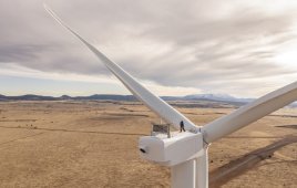
Filed Under: Turbines