Windpower Engineering & Development

  • Home
  • Articles
    • Most recent posts
    • News
    • Featured
  • Resources
    • Digital issues
    • Podcasts
    • Suppliers
    • Webinars
    • Events
  • Videos
  • 2025 Leadership
    • 2024 Winners
    • 2023 Winners
    • 2022 Winners
  • Magazine
  • Advertise
  • Subscribe

Meet the first floating LiDAR buoy: DeepCLiDAR

By Paul Dvorak | October 27, 2016

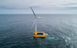
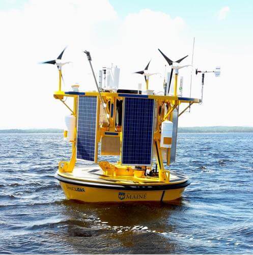
DeepCLiDAR is the first floating LiDAR buoy validated in the US providing bankable wind speed data at hub height, metocean data, and ecological monitoring services. Now available for commercial lease or purchase.

Based on results of validation testing and othr consideration, DeepCLidar meets the Carbon Trust's acceptance criteria and is capab of accurately measuring wind speed an directions across the range of met and ocean conditions.

Based on results of validation testing and other considerations, DeepCLidar meets the Carbon Trust’s acceptance criteria and is capable of accurately measuring wind speed and directions across a range of met and ocean conditions.

As a low-cost offshore wind resource for data, DeepCLiDAR will help accelerate the development of the US offshore wind industry by providing high quality, low-cost offshore wind resource data, metocean monitoring, and ecological characterization capabilities in remote marine environments.

DeepCLiDAR is 1/10th the cost of traditional meteorological tower for wind resource assessments, deployable in virtually any water depth, capable of providing bankable wind speed data up to 200-m above sea-level, has a fully-integrated metocean sensor package that provides wave and current data, and offers an optional ecological monitoring sensor package for permitting efforts developed with the Biodiversity Research Institute.

DeepCLiDAR technical overview

LiDAR: Windcube Offshore, measures wind speed at 40 to 200-m heights; GLGH Stage 3 acceptance for use in formal wind resource assessment campaigns

Other sensor packages include Metocean: wave, wind, and current; Ecological: acoustic, bird, bat, and fish

Hull and construction are aluminum, 3-m discus buoy, fully seal welded with main central hatch for all data and power control electronics

Telemetry: GOES, CDMA/GSM, IRIDIUM

Mooring: Shallow water – chain with gravity anchor; deep water – chain/wire/chain with gravity anchor

Power: System is autonomous, deployable for one year without regular maintenance


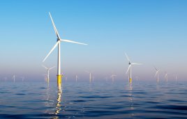
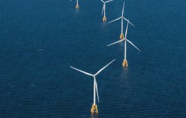
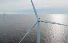
Filed Under: Offshore wind
Tagged With: U of Maine
 

About The Author

Paul Dvorak

Related Articles Read More >

Atlantic Offshore lease sale opens millions of acres to wind development
Walney Extension Offshore Wind Farm
Construction starts on New York’s 924-MW Sunrise Wind offshore project
First monopile installed in Coastal Virginia Offshore Wind project
New York union laborers will build port supporting Empire Wind offshore project

Podcasts

Wind Spotlight: Looking back at a year of Thrive with ZF Wind Power
See More >

Windpower Engineering & Development Digital Edition

Digital Edition

Browse the most current issue of Windpower Engineering & Development and back issues in an easy to use high quality format. Clip, share and download with the leading wind power engineering magazine today.

Windpower Engineering & Development
  • Wind Articles
  • Solar Power World
  • Subscribe to Windpower Engineering
  • About Us/Contact Us

Copyright © 2025 WTWH Media LLC. All Rights Reserved. The material on this site may not be reproduced, distributed, transmitted, cached or otherwise used, except with the prior written permission of WTWH Media
Privacy Policy | Advertising

Search Windpower Engineering & Development

  • Home
  • Articles
    • Most recent posts
    • News
    • Featured
  • Resources
    • Digital issues
    • Podcasts
    • Suppliers
    • Webinars
    • Events
  • Videos
  • 2025 Leadership
    • 2024 Winners
    • 2023 Winners
    • 2022 Winners
  • Magazine
  • Advertise
  • Subscribe