Joel Cline, Meteorologist, Wind Program
Deep in the heart of the Columbia River Gorge in Washington and Oregon, an extensive data collection effort is underway. It’s all part of the Wind Forecasting Improvement Project in Complex Terrain’s (WFIP 2) effort to improve wind forecasts.
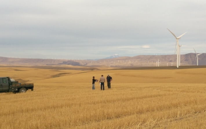
Project team members from WFIP 2 meet at the Biglow Canyon Wind Farm, a data collection site in Sherman County, Oregon. Photo: Justin Sharp, Vaisala
From October 2015 through mid-2017, scientists will collect and analyze meteorological data in order to improve wind forecasts in regions of complex terrain, such as mountains, valleys, and river gorges. Our aim is to generate better forecasts that will help make wind power more reliable, efficient, and easier to integrate into the power grid.
The project and partners
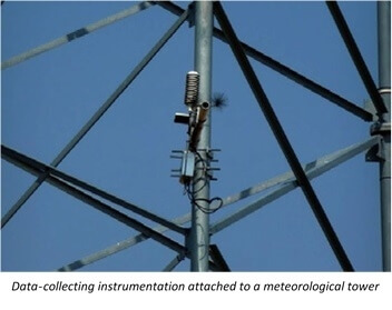
The Energy Department is leading the WFIP 2 project, with nearly $9 million in funding to six principal project partners. Each partner provides and maintains meteorological instruments and equipment in the field campaign. Advanced instruments such as light detection and ranging or LiDAR—which is a series of lasers that measure their reflection to characterize the wind at various altitudes—will capture a detailed picture of the wind; this system will measure wind speed and direction, temperature, moisture, air pressure, and solar radiation at various levels of the atmosphere, during all four seasons at 18 different data-collection sites.
In total, researchers will use 56 different meteorological instruments to collect data. This allows the team to improve our understanding about complex physical processes in the atmosphere such as stability (the smoothness of wind flow patterns), turbulence (unsteady movement of air), frontal passages (the movement of the zone between two air masses of different density), and winds modified by the nearby mountains. Because forecasting errors at turbine heights can result in significant problems, a better understanding of these important variables in wind forecasts will improve the performance and durability of wind turbines in the Columbia River Gorge region. Using the collected data, scientists will work to model the dynamics of wind at the small-area scales of wind energy plants.
The WFIP 2 field campaign builds on the first Wind Forecast Improvement Project (WFIP). This previous field campaign was conducted in the relatively flat lands of the northern Great Plains and western Texas from August 2011 to September 2012. In these locations, forecast accuracy improved up to 15 percent in short-term forecasts (less than 15 hours) by integrating collected data into existing wind models. However, forecasting winds in areas of complex terrain, such as the Columbia River Gorge region, is challenging. The slightest change in terrain can lead to drastically different wind speeds and directions—even between neighboring wind farms—which can lead to errors in forecasts. Previous testing was performed on clear days in flat terrain and did not account for changes in topography, so the WFIP 2 will help us get a clearer picture for more accurate forecasting.
 Once the field campaign is completed, our data will be used to improve short-term (up to 45 hours) wind forecasts produced by the widely used Weather Research and Forecasting Model(WRF), as well as the Rapid Refresh (RAP) and High Resolution Rapid Refresh (HRRR) models. Improvements will be transferred to the operational weather forecast models at the National Weather Service, private industry, and other international forecast centers. Additionally, researchers will develop decision support tools that allow wind plant operators to better predict how much electricity can be generated by their wind turbines. Power grid operators can then create better power generation schedules that allow wind power to be used more efficiently. In the end, the WFIP2 project will reduce energy costs and lead to more wind energy lighting up our power grid.
The Wind Program supports efforts to accurately define, measure, and forecast the nation’s land-based and offshore wind resources. Visit the wind resource assessment and characterization page for more information on how the Department is helping wind farms to supply clean, renewable power to businesses and homeowners at lower costs.
Fast facts about WFIP 2
- The first WFIP study was conducted in 2011-2012 in the flat terrain of the northern Great Plains and western Texas, while the WFIP2 study is underway in the topographically dynamic Columbia Gorge region of Washington and Oregon.
- The two year study will collect forecasting data utilizing 56 different meteorological instruments.
- The WFIP2 project will reduce energy costs by generating better forecasts that will help make wind power more reliable, efficient, and easier to integrate into the power grid.
Filed Under: News