Editor’s note: This article comes from sodar manufacturer Second Wind
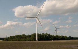
Measuring wind in complex terrain is becoming increasingly critical as more of the ideal, flat, windy sites available for windpower are developed. Ground-based, portable remote sensing is ideal for measuring wind in complex terrain because it’s hard to put up towers, and developers can measure more without investing in additional towers.
Measuring wind in complex terrain presents challenges because complicated wind flow can cause bias in speed measurements. Through several collaborative research efforts, Second Wind has developed a way to factor Triton data so it measures wind more accurately in such terrain.

Complex terrain is modeled using a CFD package with inputs tuned to account for known environmental characteristics and Triton mathematics.
At the last Triton Users Group, Second Wind’s founding partner Ken Cohn led a panel with participation from customers who worked with us in two of the recent joint research projects: Lucille Olszewski, director of meteorology at Edison Mission Group, and Hal Romanowitz, president, and Roby Maxwell, resource assessment engineer at Oak Creek Energy Systems.
How Complex Terrain Affects Triton Measurements
The mathematics used for calculating windspeed and direction in the Triton sodar (and commercial lidar devices) assumes that wind flows across the device in a straight line. Because of the potential for curved wind flow, this may not be true in complex terrain. As shown in the illustration above, the flow angles may be different as they cross Triton’s three beams. The typical flow curvature causes a low wind-speed bias ranging from 2% to 8%.
The goal of the research was to evaluate whether CFD software, in this case Metodyn, used to model wind flow, could be used to predict the low bias. We would then calculate an adjusent factor for more accurate data. The researchers completed two sets of measurement and adjusents and compared the results. For each site, they:
- Measured the wind with a Triton for several months
- Input topographical and other characteristics to create a CFD model for the flow over the site
- Calculated a complex terrain compensation factor, called the CT factor, to adjust the Triton data.
Complex terrain (above) is modeled using a CFD package with inputs tuned to account for known environmental characteristics and Triton mathematics.
Then they compared the CT-factored Triton data with met tower data also adjusted using the CFD software to account for the small differences in the Triton and tower locations. The towers were used in this research to generate the reference data. In the future, the company believes it will be possible to use Triton data alone.
It’s even more important to understand wind flows in complex terrain because of the way wind campaigns are commonly conducted, says Cohn.
“Typically, developers put up a tower at the windiest spot on a site. It becomes a problem to understand the entire site and plan the wind farm. This can result in errors, often an over-prediction of the wind resource,” Cohn says.
The panelists agreed that the study provided insight to difficulties of measuring in complex terrain and their particular wind sites. Using new siting guidelines developed for Triton boosted data recovery, and using multiple Tritons to characterize the sites resulted in more certainty about the wind resource around the site.
“A model is only as good as the inputs into the model,” says Cohn. “When you’re trying to design a wind farm on a complex site, you need to measure as much as possible.”
Second Wind
www.secondwind.com
Filed Under: Uncategorized