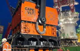
AXYS Technologies Inc (AXYS) announced that the company’s FLiDAR WindSentinel buoy has been deployed in Brittany, France as part of the energy assessment for the Bay of Saint-Brieuc commercial offshore wind farm development managed by Ailes Marines.
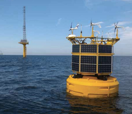
The WindSentinel system can accurately measure wind speed and direction offshore, and at a wind-turbine’s hub-height. It also offers multiple redundant power-supply systems to ensure long-term operation.
The WindSentinel system will be deployed for a minimum of 12 months to gather comprehensive wind speed and wind direction data up to heights of 200 m, along with metocean data including directional waves, ocean currents, tide, salinity, water temperature, atmospheric pressure, and air temperature.
“AXYS is delighted to work with Ailes Marines to support the development phase of this offshore wind farm in France,” says Terry Tarle, AXYS President & CEO. “This WindSentinel system, equipped with fully redundant LiDAR systems, enables us to meet the projects’ high-data availability and reliability requirements and ensure project success.”
The FLIDAR WindSentinel system’s dual LiDAR sensors allow it to more accurately measure the wind resource and expected energy production at the offshore wind farm.
“Ailes Marines selected the AXYS WindSentinel based on its innovative technology and proven track record of providing reliable data from offshore systems,” says Ailes Marines Wind Engineer and Project Manager, Jerome Dumont. “We also consider that the high load capability of the WindSentinel is potentially advantageous in allowing accommodating various device options and redundancies in measurement systems — thus, it may help adapting to specific requirements of developers so as participate in reducing risk levels on data recovery during the Wind Assessment Campaign.”
The WindSentinel is a rugged wind resource assessment system that uses LiDAR to accurately measure wind speed and wind direction offshore. With this deployment AXYS continues to grow its position as the world leader in offshore wind assessment, having supplied 18 commercial floating LiDAR systems around the world that have recorded more than 17 years of offshore data.
Filed Under: News, Offshore wind, Projects