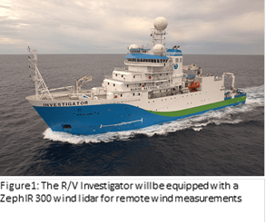
An international team of scientists will head to the remote Southern Ocean with a ZephIR 300 wind lidar and provide the project’s remote wind measurements onboard the R/V Investigator, an Australian deep-ocean research vessel. The U.S. portion of the project is funded by the National Science Foundation (NSF).
The team’s discoveries will be used to improve climate models, which routinely underestimate the amount of solar radiation reflected back into space by clouds in the region. Accurately simulating the amount of radiation that is absorbed or reflected on Earth is key to calculating how much the globe is warming.
“SOCRATES will allow for some of the best observations of clouds, aerosols, radiation, and precipitation that have ever been collected over the Southern Ocean,” said Greg McFarquhar, a Principal Investigator and the Director of the University of Oklahoma Cooperative Institute for Mesoscale Meteorological Studies (CIMMS). “These data will provide us with critical insight into the physics of cloud formation in the region, the information we can use to improve global climate models.”
The field campaign, called the Southern Ocean Clouds, Radiation, Aerosol Transport Experimental Study, or SOCRATES, could also help scientists understand the very nature of how clouds interact with aerosols — particles suspended in the atmosphere that can be from either natural or from human-made sources. Aerosols can spur cloud formation, change cloud structure, and affect precipitation, all of which affect the amount of solar radiation that is reflected.
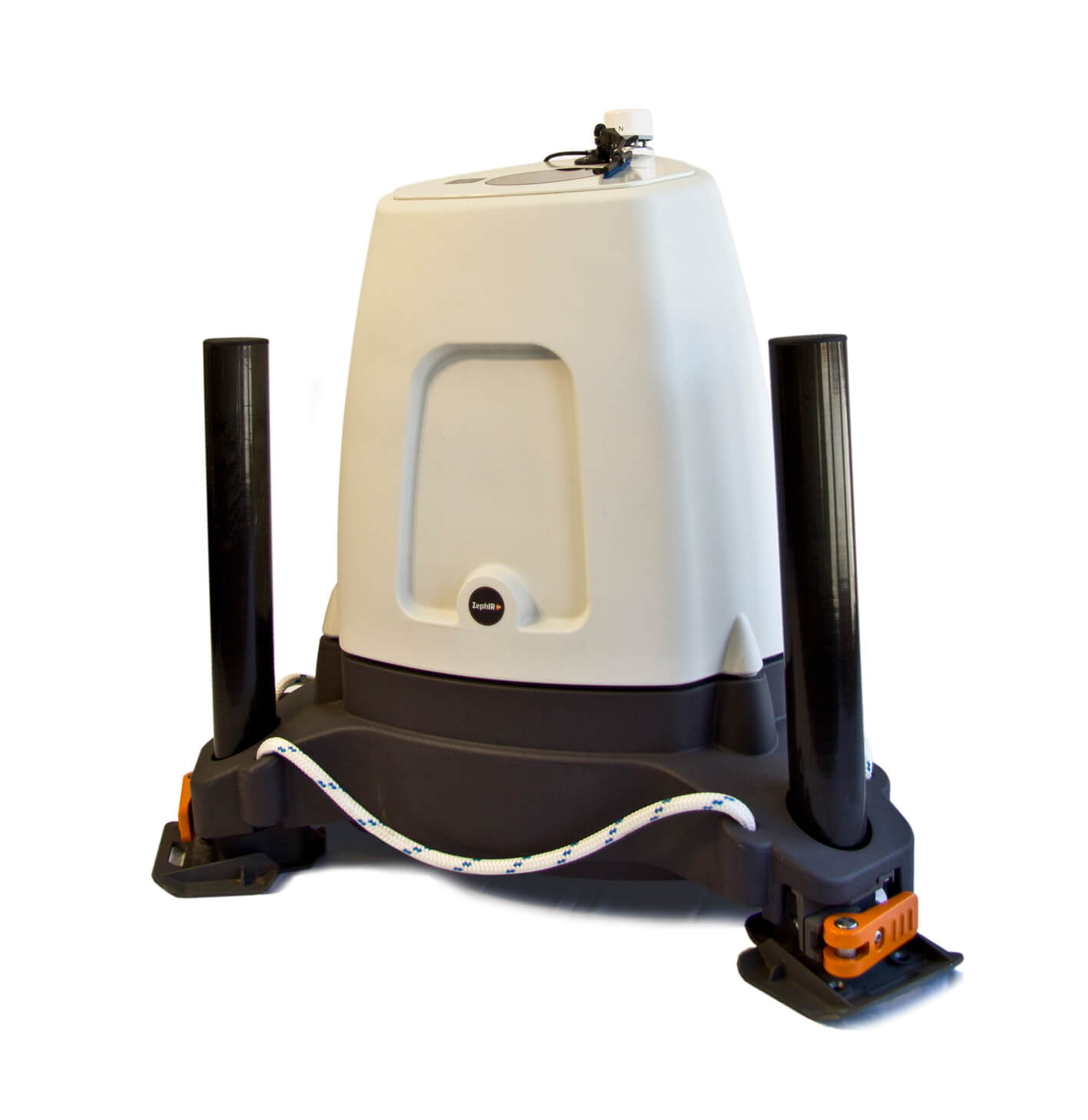
The vessel-installed ZephIR 300 wind lidar will provide advanced wind measurements from 10 to 200 meters above the deck of the research vessel. The study is scheduled for mid-January and will end in February 2018.
“We’ll be able to use this information to understand cloud behavior closer to home and how clouds are likely to adjust to changing climatic conditions,” explained Eric DeWeaver, Program Director for Climate and Large-Scale Dynamics in the National Science Federation’s Geoscience Directorate.
“Much of what we currently know about Southern Ocean cloud, aerosol, and precipitation properties comes from satellite-based estimates, which are uncertain and have undergone few comparisons against independent data,” said Co-Investigator Roger Marchand, a Scientist at the University of Washington.
During the mission, scientists will use data from a collection of advanced instruments packed onboard a research aircraft that is owned by the NSF and operated by the National Center for Atmospheric Research (NCAR) and a research vessel that is operated by Australia’s Commonwealth Scientific and Industrial Research Organisation (CSIRO).
“Observations from the ship will help us understand the background state of the atmosphere — how it’s behaving,” said National Center for Atmospheric Research scientist Bill Brown, who traveled to Australia in late November to prepare for the voyage.
The ship will be deployed for the entire six weeks and will face its own challenges, notably, the notorious roughness of the Southern Ocean sometimes called the stormiest place on Earth.
“There are no land masses to break up the winds down there,” Brown said. So the ocean can be quite rough.” The ZephIR 300 wind lidar is the industry-standard Lidar offshore and is very experienced in handling the conditions expected to be encountered on the project.
For more about the SOCRATES campaign, click here.
Filed Under: News, Offshore wind, Projects, Sensors